#include <chartdb.h>
Collaboration diagram for chart_georef_t:
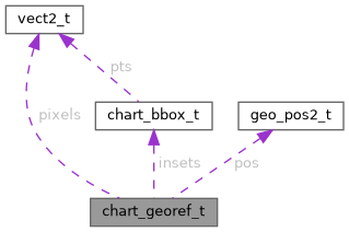
Data Fields | |
| bool_t | present |
| vect2_t | pixels [2] |
| geo_pos2_t | pos [2] |
| size_t | n_insets |
| chart_bbox_t | insets [16] |
Detailed Description
Chart geo-referencing data. This data consists of two sets of data points
- two pixel coordinate points in the
pixelsfield - two geographic coordinate points in the
posfield The points are meant to overlay each other, sopixels[0]gives the graphical position of geographic coordinatepos[0]and same for index 1.
In addition, there's an optional number of chart insets, which are boxes on the chart (their two corners given in pixel coordinates), for which the georeferencing data is invalid. Those are typically things like overlaid legends, or not-to-scale regions. You prevent an airplane symbol from appearing in those insets, as it might confuse the crew as to the position of the aircraft.
Field Documentation
◆ insets
| chart_bbox_t insets[16] |
◆ n_insets
◆ pixels
◆ pos
| geo_pos2_t pos[2] |
◆ present
The documentation for this struct was generated from the following file:
- acfutils/chartdb.h